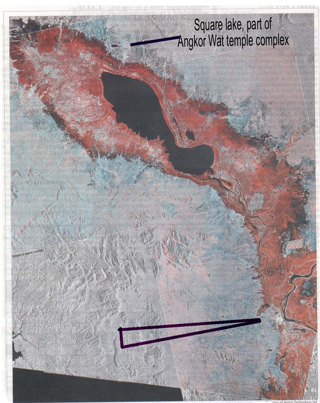
On the satellite image below, the red area is the flooding along the Mekong River and its tributaries in Cambodia. The large black area in the upper left is Tonle Sap Lake. The lower arrow points to the Phnom Penh area which is not flooded much because it is protected by a dike.
